Quantcast
Channel: Norway
Viewing all articles
Browse latest Browse all 11

Sentinel-1 imagery maps Norway ground movement

$
0
0
Sentinel-1 imagery maps Norway ground movement
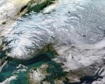
Norway as seen by MODIS on board of Aqua satellite on 16 January 2017. Image: NASA/ edited by antilip.

A consortium of Norwegian institutions has used Copernicus Sentinel-1 satellite data in combination with the Interferometric Synthetic Aperture Radar (InSAR) remote sensing technique to map ground movements in the country. The Geological Survey of Norway (NGU), the Norwegian Water Resources and Energy Directorate (NVE) and the Norwegian Space Centre (NSC) make results freely accessible through InSAR Norway, a service launched in November 2018.

Svenja HoffmannThu, 03/07/2019 - 10:14

Viewing all articles
Browse latest Browse all 11

Latest Images

Trending Articles


Latest Images